This is the part of a series of posts examining how to create super-packed districts of one race. The other posts in this series pack Asians, blacks, Hispanics, and Native Americans.
The Districts
The previous post stated that
I drew a lot of districts in the quest for the whitest district of them all. It wouldn’t do the difficulty of this task justice to just show one district. Rather, I will show the five whitest districts of all the ones that I drew. Numbers five and four will be in this post. The top three will be in the next one.
The fifth-whitest district was in the state of Indiana, the fourth whitest was in the state of Kentucky.
Now for the third-whitest district.
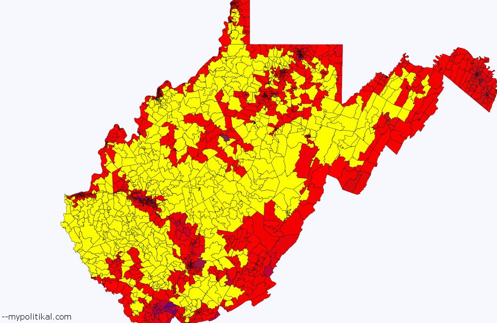
#3: West Virginia
Population – 98.2% white, 0.3% black, 0.5% Hispanic, 0.2% Asian, 0.2% Native American, 0.7% other
More below.
West Virginia is home to the third whitest district. This district is the most compact of all the districts presented here, essentially taking in all of rural West Virginia. Interestingly, despite being almost exactly one-third of the state’s population, it covers the vast majority of West Virginia’s land area. West Virginia is not commonly thought of as an urban state – but even this part of America is urbanized to a striking degree.
Politically, this district used to constitute the core of white working-class, pro-union Democratic strength. It probably voted Democratic in 1988, 1980, and 1968 – all years in which the Republican presidential candidate pummeled the Democrat. During the 21st century, however, it shifted strongly Republican. President Barack Obama lost the district in 2008, and it would be extremely surprising if he wins it in 2012.
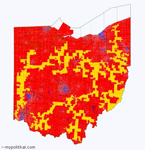
#2: Ohio
Population – 98.2% white, 0.3% black, 0.6% Hispanic, 0.2% Asian, 0.1% Native American, 0.7% other
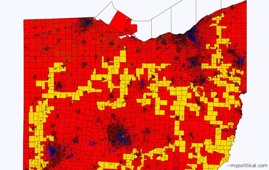
The second whitest district of them all belongs to the ultimate swing state, Ohio. Here are some closer views. The northern part of the district:
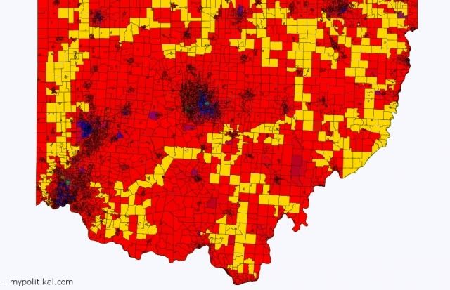
And now the southern part of the district:
The key to this district is the size of Ohio. Because Ohio is such a populous state, the district is free to sprawl throughout the state in search of only the whitest precincts. This is something that wasn’t possible in Kentucky or West Virginia, and it’s why the district is slightly whiter – despite Ohio overall having a much lower white population.
Rural whites in Ohio are also quite conservative. Politically this district gave President Barack Obama 36.1% of the vote in 2008; Senator John McCain took 61.7% of the vote. The “average” Democrat from the years 2006 to 2008 won 45.6% of the vote; the “average” Republican won 54.4% of the vote. Both numbers overstate Democratic strength here, since 2006 to 2008 were very good years for Democrats.
#1: Pennsylvania
Population – 98.6% white, 0.2% black, 0.4% Hispanic, 0.2% Asian, 0.1% Native American, 0.5% other
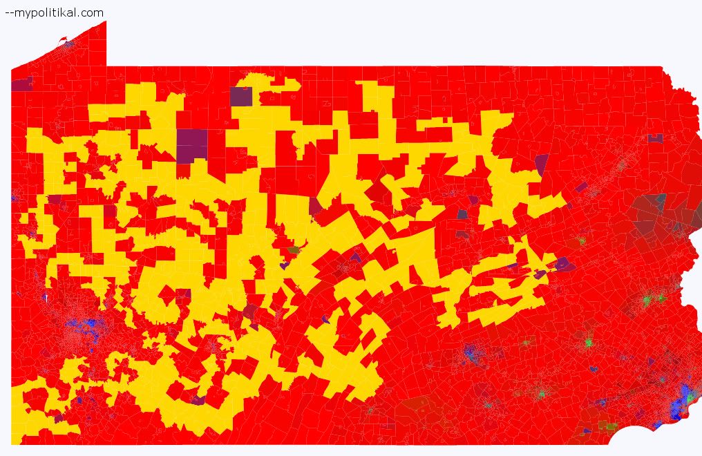
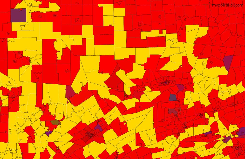
Surprise! The whitest district of them all is in Pennsylvania, a state which you probably weren’t guessing.
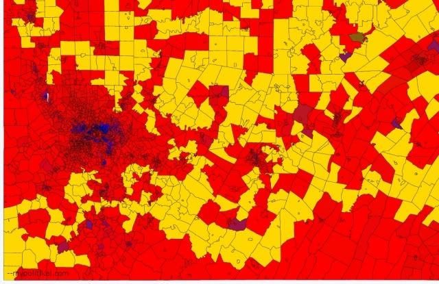
Here are some closer looks. The southwest part of the district:
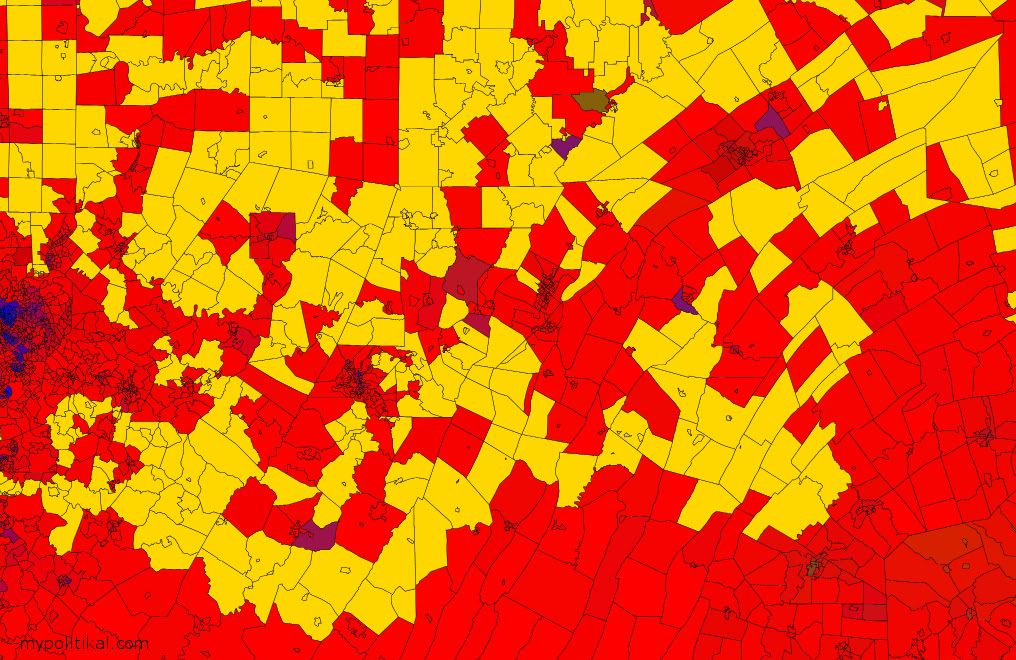
The southeast:
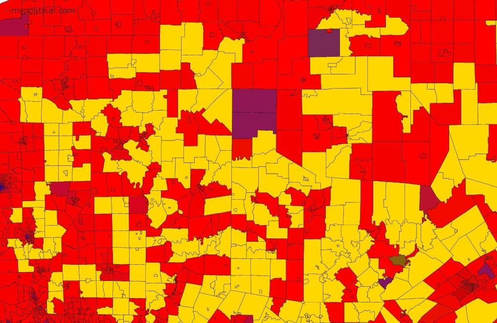
The northwest part of the district:
The northeast:
Like Ohio, Pennsylvania benefits from being a very populous state; the district can freely reach into only the whitest areas. And apparently central and eastern Pennsylvania are extremely white regions.
Geographically, this district covers a lot of ground. Remember that the people living here compose only 1/18th of Pennsylvania’s total population. And yet the district is certainly a lot bigger than 1/18th of Pennsylvania’s total land area.
Politically, this district has a lot in common with the Indiana and Ohio districts. It gave President Barack Obama 37.2% of the vote and Senator John McCain 61.3% of the vote in 2008. Pennsylvania may be a Democratic-leaning state, but rural Pennsylvania whites are not anymore liberal than rural Indiana and Ohio whites. Moreover, this district has probably always been Republican-leaning. Parts of it, especially in the southwest, once were quite Democratic. But the eastern part of the district outnumbers the southwest. Located in Pennsylvania’s “T”, those eastern reaches have been a Republican stronghold for a very long time.
Conclusions
Most people say that the whitest part of the United States is in New England. That’s technically true, if one includes New England’s snow-white non-rural areas. But, as this post shows, the part of the United States with the highest percentage of whites is actually located elsewhere.
There are several ways to describe the region. It’s entirely rural; the cities and suburbs in the region are not included. Parts (or all) of Illinois, Indiana, Kentucky, Ohio, New York, Virginia, and West Virginia cover it. One way to describe it would be as the basin of the Ohio River. Another way would be as the Appalachian Mountains and the forested areas to their north.
Whatever the description, minorities have never settled in this part of the United States. African-Americans generally live in the South and, outside of the South, in cities. Hispanics generally live in the Southwest and, outside the Southwest, in cities and economically growing regions. Asians generally live in California and Hawaii and, outside those two states, in suburbs. This region is thus the whitest part of the America, and will probably continue to be so for many, many years to come.
–inoljt
2 comments