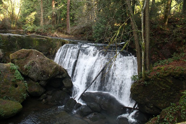
Upper Falls, Whatcom Creek, Whatcom Falls Park, Bellingham, WA
Whatcom Creek is the third salmon spawning stream that runs through Bellingham. I promised in my last diary that it would be the last. However, I took so many photos and there was too much stuff. So, here I will describe the creek and its history. The next one will focus on both the primeval timelessness of the creek itself and illustrate how its two fish hatcheries are working to keep this marvelous place for future generations.
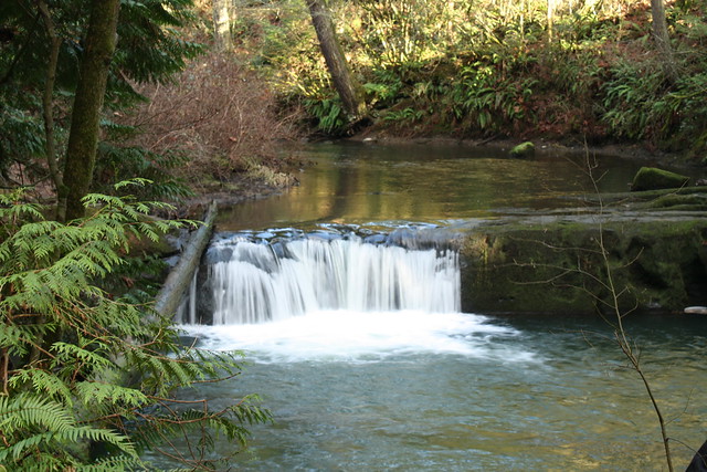
Small falls over Chuckanut Sandstone with pool
Whatcom Creek drains from Lake Whatcom which is a glacially scoured lake on the edge of town, extending 10 miles to the south. A sizeable portion of the shoreline and surrounding watershed is privately owned residential property. Another portion, donated by the early 20th Century lumber mill owners was deeded to the City and is now a wonderful city park – Bloedel-Donovan Park.
Prior to the arrival of Caucasians, Northwest Coast Salish Tribes had villages along the south end of the lake where they flourished with the abundance of fish and forest wildlife. The first non-native settlers began occupying the lake shore in the late 1850s. Logging and lumber mills quickly dominated the northern shores of the lake while coal mining invaded the south end. Although the mills no longer exist, vestiges of their once dominant presence remain in the form of pilings and train trestles.
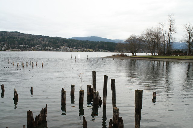
Lake Whatcom and Bloedel-Donovan Park with pilings from the days of sawmills
In all, it is a beautiful lake. However, the purity of the sparkling blue waters is less pristine that it would appear. The lake continues to be threatened by residential runoff and hence the creek water is threatened as well. A hundred years of attempts at conservation have not been effective. In 1906, the city noted that the kokanee (Landlocked sockeye salmon) were decreasing in size. To stem the pollution that they thought was responsible for the undersized fish, swimming was banned in the lake. To enforce this ban, a patrol boat made regular rounds to ward off swimmers.
One hundred years later the City and County eventually banned two-cycle boat engines from the lake – fortunately swimming is now allowed. Still there is the residential runoff from septic tanks and lawn fertilizers (which are now controlled for phosphorus), along with automobile emissions and leakages that contribute to its despoilment. Major efforts continue to target the various sources of pollution. In March of 2013, Whatcom County Council voted to set aside a new Lake Whatcom Forest Preserve Park, that will protect more than a quarter of the lake’s watershed. This preservation is critical as the lake is the source of nearly one half of the County’s drinking water.
Whatcom creek then flows out of the lake under Electric Street and into a pond that is contained by a dam controlling water level in the lake and the creek. (Adjacent to the pond is wetland owned by the State Audubon Society as a wildlife sanctuary.)
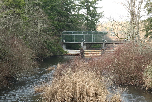
Lake Whatcom dam spilling into the beginning of Whatcom Creek.
From the dam the creek enters Whatcom Falls Park that has been in existence for over 100 years. For the most part the creek’s riparian habitat has remained pristine. From the dam the creek, also fed by several tributaries, flows 2.7 miles to Bellingham Bay through two additional parks, two fish hatcheries, and majestic stands of mature second growth forest (fir, cedar, alder, maple).
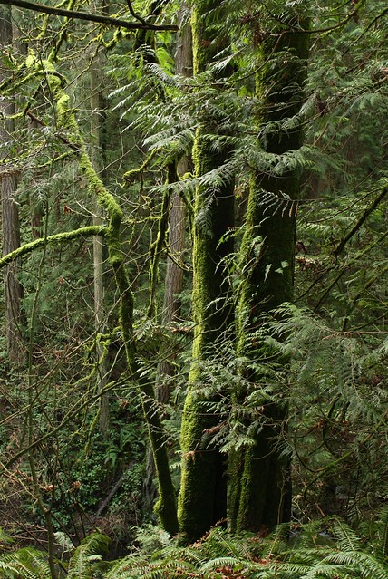
Moss grows all over trees here
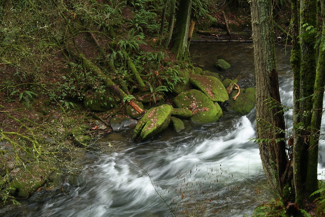
A picturesque segment of the creek within Whatcom Park
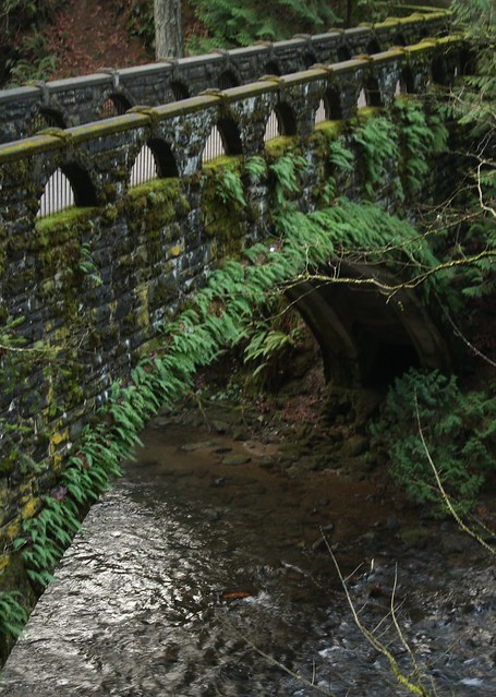
This bridge was built in 1939 by Roosevelt’s Work Progress Administration
Much of the vertical drop of the creek from the lake occurs within the park boundaries leaving a series of picturesque waterfalls, pools, and white water cascades. Its last mile is less photogenic as it flows under Interstate 5, by a number of commercial and light manufacturing businesses and residential areas, and finally through the heart of town and behind City Hall.
Like Padden and Squalicum creeks previously documented, Whatcom Creek’s habitat too was desecrated numerous times over the past 150+ years. More recently, it suffered a particularly devastating blow. In 1999 an underground gasoline pipe line routed under the western edge of the park burst spilling 237,000 gallons of unleaded gas into the creek and its tributary, Hanna Creek. Somehow it ignited and in just 30 seconds, 1.5 miles of the creek’s riparian habitat was burned to a crisp. More tragic however, was that the lives of three young children fishing along the creek were lost in the fire.
Fish and wildlife impacts were impossible to fully quantify. Field staff collected or observed more than 100,000 dead salmon, trout, lamprey, and crayfish in the days following the fire. Scientists concluded that all aquatic life in three miles of Whatcom Creek and its tributaries was killed.
In addition, the leak caused the demise of approximately 26 acres of trees and vegetation, including 16 acres of mature second-growth forest within Whatcom Falls Park through direct contact with the fuel or fumes, or when the fuel ignited.
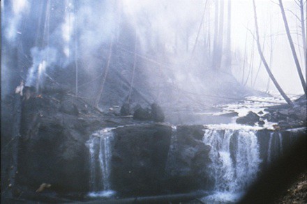
The Middle Falls of Whatcom Creek still smoldering, June 1999
Renewal
Although the creek’s habitat had been under restoration prior to the fire, they had to do a restart for a significant portion of the creek. If anything fortunate can be said to have come of this tragedy, the settlement with the pipe line company provided 3.4 million dollars for habitat restoration in addition to family compensation for the children lost. The offending Olympic Pipeline Company, (a subsidiary of BP) was found at fault due to negligence and as part of their responsibility for the inferno planted 40,000 trees as part of a larger emergency reparation plan. All levels of government assistance and oversight were brought to bear on the clean up and rehabilitation.
Under the Oil Pollution Act (OPA) of 1990, the parties responsible for the release of petroleum products are liable for the costs to restore natural resources. An oversight board, called the Natural Resource Trustees was established; its members include: the United States Department of Commerce as represented by the National Oceanic and Atmospheric Administration; the United States Department of the Interior as represented by the United States Fish and Wildlife Service; the State of Washington as represented by the Department of Ecology; the Lummi Nation of Washington; the Nooksack Tribe of Washington; and the City of Bellingham, appointed by the Governor. The Trustees oversaw the initial emergency response actions and development of a Long-term Restoration Plan designed to determine the impacts of the spill on natural resources and identify measures that would be implemented to restore those injured resources.
The Trustees and the Olympic Pipe Line Company established a fund of $500,000 from which all long-term monitoring and maintenance activities related to this incident are supported.
The settlement agreement particularly provided funds for restoration of in-stream habitat and riparian areas within the burned area as well as for several other large in-stream restoration projects. From 2003 through 2006, the city planted more than 20,000 trees, removed over 800 cubic yards of invasive plants, and restored numerous sites in the riparian corridor along lower Whatcom Creek. By 2009, these projects were completed but the growth and final development will take maybe decades to return to its pre-1999 state.
One of the areas damaged by the fire, midway between the leakage and the downtown areas is called Red Tail Reach. This area of the creek runs behind a commercial area populated largely by car dealerships. It was badly burned and is close to where the children were caught in the conflagration. The Red Tail Reach habitat restoration project, just upstream from Interstate-5, involved excavating contaminated creek bed soil and developing features such as oxbows, side channels, floodplain area, wetlands and uplands. This design mimicked “historic” channels, creating extensive off-channel rearing habitat, which is used primarily by juvenile Coho salmon.

Red Tail Reach habitat coming back
On Earth Day (April 22) 2007, the Lummi Nation held a Healing Ceremony near the Red Tail Reach project where a Memorial Pole and two carved cedar benches had been installed. The ceremony was held to honor the three boys killed during the incident as well as the restoration of the salmon spawning creek itself. Settlement funds were used to pay for the carving of the pole and benches and are considered part of the effort to address impacts of the incident on the community.
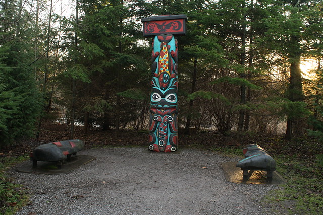
Memorial Totem Pole and Benches at Red Tail Reach
Although not solely due to the fire, the creek’s health remains questionable as are the other creeks previously examined. Whatcom Creek water is listed as “impaired” for temperature, fecal coliform, and dissolved oxygen levels, mostly due to human and animal waste and run off from the Lake Whatcom watershed. The most direct effect of the fire was the loss of vegetation within the burn zone, leading to the reduction in shade and associated cooling properties of mature streamside forest vegetation.

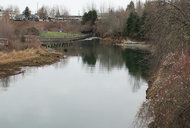
The Creek runs through town wending its way toward the Lower Falls where it then empties it into the estuary.
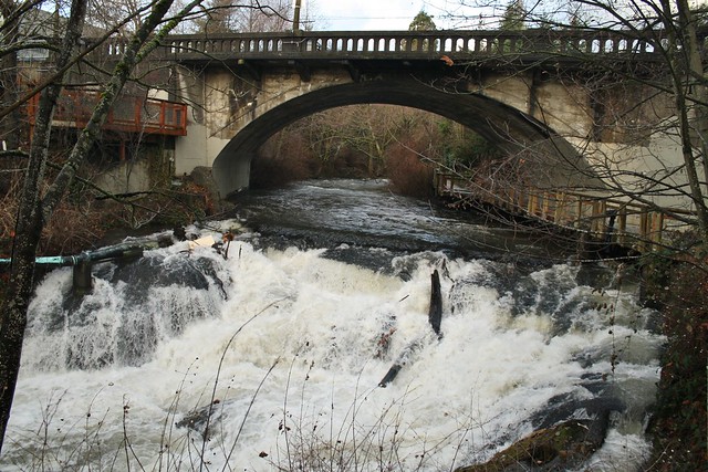
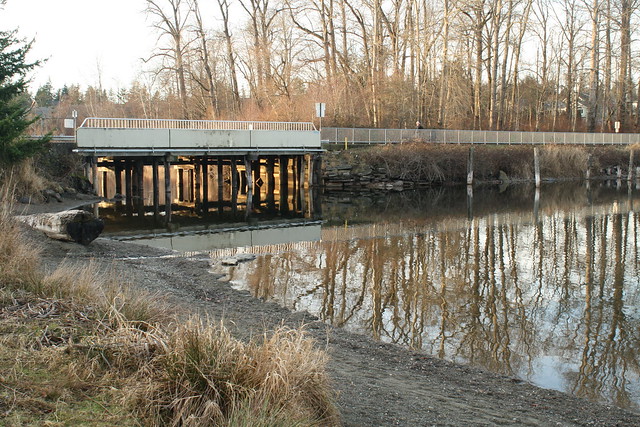
Lower Falls of Whatcom Creek running under the George E. Pickett Bridge, just above the estuary
The Lower Falls ushers Whatcom Creek into its estuary surrounded by Maritime Heritage Park and a fish hatchery that raises Chum and Chinook salmon and Steelhead trout that are released into the estuary. I will describe the hatchery operation in a subsequent diary.
Like the other two creeks, Whatcom creek’s estuary flows under train trestles and bridges and around major industrial works. It used to flow by a Georgia Pacific pulp and paper mill that has since closed, although its soil remains contaminated with mercury and other chemicals used in processing of paper products. The former mill site is currently being decontaminated by the city and port authority and is being prepared for a major urban development including residential, retail, and open space and parks.
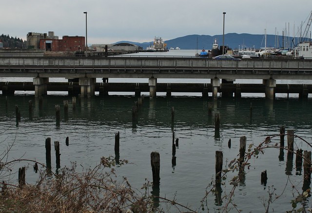
As seen in the photo below, Whatcom Creek also flows directly under a waterfront bar and past the docked Arctic Challenger of Shell Oil fame, before entering Bellingham bay. Both naturally spawned and hatchery salmon then enter the Salish Sea through this seemingly inhospitable waterway that eventually leads them to the Pacific Ocean on their journey to the Gulf of Alaska, only to return in three to five years. (See the next episode.)
The estuary looking south from the Lower Falls as it flows under the Waterfront Bar
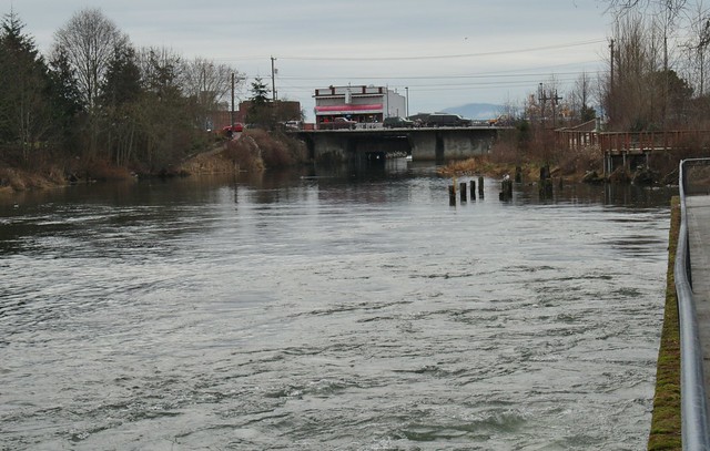
The estuary looking north from the bridge toward the Lower Falls. Fish hatchery is on the left
Looking south from the bridge along Whatcom Waterway and into Bellingham Bay. GP buildings are to the left, Arctic Challenger top center (yellow)
Given our propensity to build by the water, I guess it is inevitable that all three creeks described in this series end up flowing under roads and freeways, train trestles, and through industrial areas that border Bellingham Bay. In spite of these sources of pollution, I have to commend our community, particularly the progressive elements of which we have a slight majority, for championing clean up and keeping as best we can, a watchful eye on the future.
With the ever-present potential polluters lurking everywhere, even under a pristine park and creek, we must continue to be vigilant and wary of fossil fuel transportation. Over the train trestle in the above photo, as well as those in the previous two diaries, coal is now transported from Wyoming and Montana to British Columbia for shipping to Asia. Crude oil is now also traveling over these same tracks for refining a few miles to our north. Plans are pending to significantly increase these coal shipments in the coming years. Even larger plans are in the works to hugely increase the crude oil shipment from the North Dakota Bakkan Fields and from the Alberta Tar Sands to our county and through British Columbia. Current proposals call for over 400 oil tanker ships per year, up from 30 a decade ago. These tankers would all traverse the Salish Sea and San Juan Islands. Any significant spill could wipe out wildlife of all kinds and the livelihoods of those who harvest the sea food as well as destroy recreational and tourist industries. We cannot afford a coal or oil tanker spill.
Hopefully our community has had enough of this carbon contamination and we will continue to fight for clean air and uncontaminated water for ourselves and our fish stocks.
8 comments